
Thank you for supporting this site ❤️
Make a donation
Make a donation
Rosh Pinah topographic map
Click on the map to display elevation.
Thank you for supporting this site ❤️
Make a donation
Make a donation
About this map
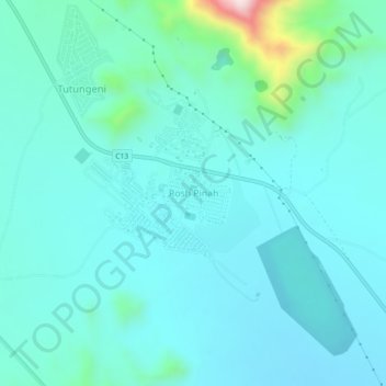
Name: Rosh Pinah topographic map, elevation, terrain.
Location: Rosh Pinah, Karas, Namibia (-27.98424 16.74108 -27.94424 16.78108)
Average elevation: 410 m
Minimum elevation: 339 m
Maximum elevation: 840 m
Thank you for supporting this site ❤️
Make a donation
Make a donation