
Thank you for supporting this site ❤️
Make a donation
Make a donation
Eliot topographic map
Click on the map to display elevation.
Thank you for supporting this site ❤️
Make a donation
Make a donation
About this map
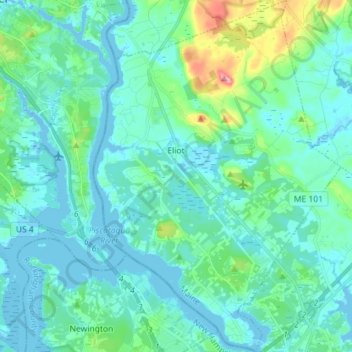
Name: Eliot topographic map, elevation, terrain.
Location: Eliot, York County, Maine, 03903, United States (43.09360 -70.83361 43.19762 -70.73313)
Average elevation: 17 m
Minimum elevation: -9 m
Maximum elevation: 107 m
Thank you for supporting this site ❤️
Make a donation
Make a donation