
Thank you for supporting this site ❤️
Make a donation
Make a donation
Żary topographic map
Click on the map to display elevation.
Thank you for supporting this site ❤️
Make a donation
Make a donation
About this map
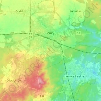
Name: Żary topographic map, elevation, terrain.
Location: Żary, Żary County, Lubusz Voivodeship, Poland (51.58490 15.08293 51.66420 15.20796)
Average elevation: 163 m
Minimum elevation: 121 m
Maximum elevation: 231 m
Thank you for supporting this site ❤️
Make a donation
Make a donation