
Volcanoes National Park topographic map
Interactive map
Click on the map to display elevation.
About this map
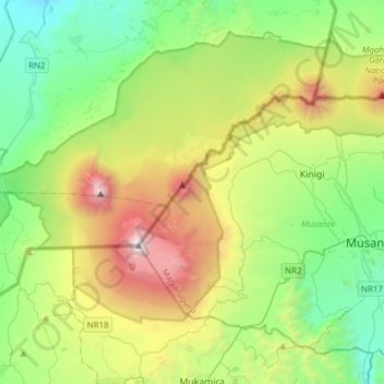
Name: Volcanoes National Park topographic map, elevation, terrain.
Location: Volcanoes National Park, Musanze, Northern Province, Rwanda (-1.56835 29.39767 -1.35906 29.70430)
Average elevation: 2,350 m
Minimum elevation: 1,353 m
Maximum elevation: 4,474 m