
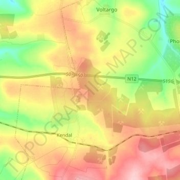
Emalahleni Ward 28 topographic map
Interactive map
Click on the map to display elevation.
About this map
Name: Emalahleni Ward 28 topographic map, elevation, terrain.
Average elevation: 1,555 m
Minimum elevation: 1,482 m
Maximum elevation: 1,626 m
Other topographic maps
Click on a map to view its topography, its elevation and its terrain.
Kriel
South Africa > Mpumalanga > Nkangala > Emalahleni Local Municipality
Hot summers and very cold winters. Rainfall approximately 660 mm per annum. Altitude 1598 m above sea level.
Average elevation: 1,569 m