
Thank you for supporting this site ❤️
Make a donation
Make a donation
Meirinhos topographic map
Click on the map to display elevation.
Thank you for supporting this site ❤️
Make a donation
Make a donation
About this map
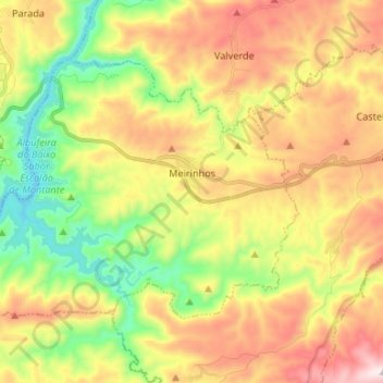
Name: Meirinhos topographic map, elevation, terrain.
Location: Meirinhos, Mogadouro, Bragança, Portugal (41.22310 -6.92093 41.29224 -6.78791)
Average elevation: 484 m
Minimum elevation: 158 m
Maximum elevation: 877 m
Thank you for supporting this site ❤️
Make a donation
Make a donation
Other topographic maps
Click on a map to view its topography, its elevation and its terrain.