
's Herenelderen topographic map
Interactive map
Click on the map to display elevation.
About this map
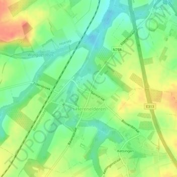
Name: 's Herenelderen topographic map, elevation, terrain.
Location: 's Herenelderen, Tongres, Limbourg, Flandre, Belgique (50.79673 5.47978 50.82236 5.51713)
Average elevation: 85 m
Minimum elevation: 63 m
Maximum elevation: 112 m
Other topographic maps
Click on a map to view its topography, its elevation and its terrain.