
Rakaia River topographic map
Interactive map
Click on the map to display elevation.
About this map
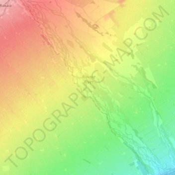
Name: Rakaia River topographic map, elevation, terrain.
Location: Rakaia River, Selwyn District, Canterbury, New Zealand (-43.90105 172.04152 -43.75224 172.20772)
Average elevation: 52 m
Minimum elevation: 0 m
Maximum elevation: 114 m
Other topographic maps
Click on a map to view its topography, its elevation and its terrain.
Springfield
New Zealand > Canterbury > Selwyn District
Springfield, Selwyn District, Canterbury, 7649, New Zealand
Average elevation: 396 m
Prebbleton
New Zealand > Canterbury > Selwyn District
Prebbleton, Selwyn District, Canterbury, 7604, New Zealand
Average elevation: 25 m
Windwhistle
New Zealand > Canterbury > Selwyn District
Windwhistle, Selwyn District, Canterbury, New Zealand
Average elevation: 434 m
Rolleston
New Zealand > Canterbury > Selwyn District
Rolleston, Selwyn District, Canterbury, 7643, New Zealand
Average elevation: 54 m
Castle Hill Village
New Zealand > Canterbury > Selwyn District
Castle Hill Village, Selwyn District, Canterbury, 7580, New Zealand
Average elevation: 787 m
Lincoln
New Zealand > Canterbury > Selwyn District
Lincoln, Selwyn District, Canterbury, 7608, New Zealand
Average elevation: 15 m
Sheffield
New Zealand > Canterbury > Selwyn District
Sheffield, Selwyn District, Canterbury, 7500, New Zealand
Average elevation: 309 m
West Melton
New Zealand > Canterbury > Selwyn District
West Melton, Selwyn District, Canterbury, 7618, New Zealand
Average elevation: 88 m
Tai Tapu
New Zealand > Canterbury > Selwyn District
Tai Tapu, Selwyn District, Canterbury, 7672, New Zealand
Average elevation: 21 m
Dunsandel
New Zealand > Canterbury > Selwyn District
Dunsandel, Selwyn District, Canterbury, 7682, New Zealand
Average elevation: 74 m
Arthur's Pass
New Zealand > Canterbury > Selwyn District
Arthur's Pass, Selwyn District, Canterbury, 7875, New Zealand
Average elevation: 1,204 m
Darfield
New Zealand > Canterbury > Selwyn District
Darfield, Selwyn District, Canterbury, 7510, New Zealand
Average elevation: 202 m
Selwyn
New Zealand > Canterbury > Selwyn District
Selwyn, Selwyn District, Canterbury, 7682, New Zealand
Average elevation: 70 m
Castle Hill Peak
New Zealand > Canterbury > Selwyn District
Castle Hill Peak, Selwyn District, Canterbury, New Zealand
Average elevation: 1,512 m
Leeston
New Zealand > Canterbury > Selwyn District
Leeston, Selwyn District, Canterbury, 7632, New Zealand
Average elevation: 22 m
Te Hāpua Waikawa / Lake Lyndon
New Zealand > Canterbury > Selwyn District
Te Hāpua Waikawa / Lake Lyndon, Selwyn District, Canterbury, New Zealand
Average elevation: 1,012 m
Kirwee
New Zealand > Canterbury > Selwyn District
Kirwee, Selwyn District, Canterbury, New Zealand
Average elevation: 158 m