
Thank you for supporting this site ❤️
Make a donation
Make a donation
Bad Feilnbach topographic map
Click on the map to display elevation.
Thank you for supporting this site ❤️
Make a donation
Make a donation
About this map
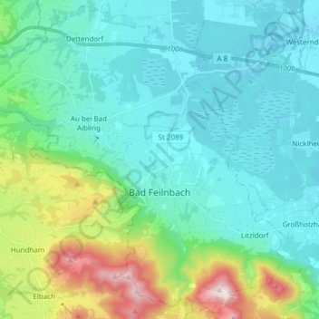
Name: Bad Feilnbach topographic map, elevation, terrain.
Location: Bad Feilnbach, Landkreis Rosenheim, Beieren, 83075, Duitsland (47.73586 11.91606 47.83415 12.06756)
Average elevation: 621 m
Minimum elevation: 453 m
Maximum elevation: 1,267 m
Thank you for supporting this site ❤️
Make a donation
Make a donation
Other topographic maps
Click on a map to view its topography, its elevation and its terrain.
Thank you for supporting this site ❤️
Make a donation
Make a donation
Wolfsschlucht (Unterer Wasserfall)
Duitsland > Beieren > Landkreis Rosenheim > Flintsbach am Inn
Average elevation: 612 m
Thank you for supporting this site ❤️
Make a donation
Make a donation