
Taos topographic map
Interactive map
Click on the map to display elevation.
About this map
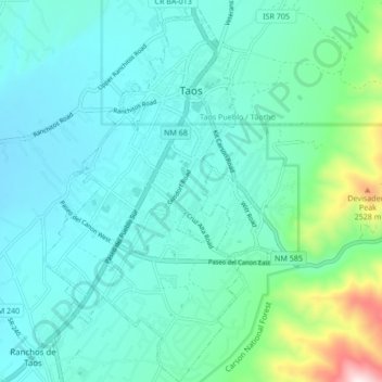
Name: Taos topographic map, elevation, terrain.
Location: Taos, Taos County, Nouveau-Mexique, États-Unis d'Amérique (36.35496 -105.60605 36.42347 -105.55629)
Average elevation: 2,180 m
Minimum elevation: 2,066 m
Maximum elevation: 2,739 m
Other topographic maps
Click on a map to view its topography, its elevation and its terrain.
Wheeler Peak
États-Unis d'Amérique > Nouveau-Mexique > Taos County
Wheeler Peak, Taos County, Nouveau-Mexique, États-Unis d'Amérique
Average elevation: 3,674 m