
Chawanta topographic map
Interactive map
Click on the map to display elevation.
About this map
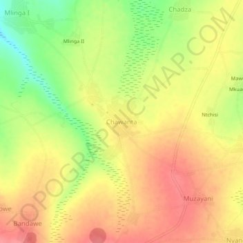
Name: Chawanta topographic map, elevation, terrain.
Location: Chawanta, Lilongwe, Central Region, Malawi, Malawi (-14.13666 33.34974 -14.09666 33.38974)
Average elevation: 1,199 m
Minimum elevation: 1,153 m
Maximum elevation: 1,228 m
Other topographic maps
Click on a map to view its topography, its elevation and its terrain.