
Thank you for supporting this site ❤️
Make a donation
Make a donation
Narhe topographic map
Click on the map to display elevation.
Thank you for supporting this site ❤️
Make a donation
Make a donation
About this map
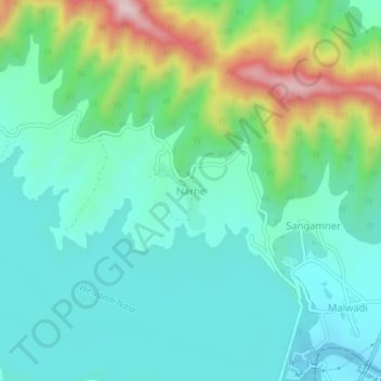
Name: Narhe topographic map, elevation, terrain.
Location: Narhe, Bhor, Pune District, Maharashtra, India (18.17200 73.83945 18.21200 73.87945)
Average elevation: 683 m
Minimum elevation: 578 m
Maximum elevation: 991 m
Thank you for supporting this site ❤️
Make a donation
Make a donation