
North Gosforth topographic map
Interactive map
Click on the map to display elevation.
About this map
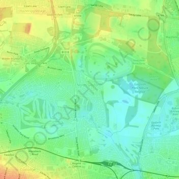
Name: North Gosforth topographic map, elevation, terrain.
Average elevation: 58 m
Minimum elevation: 42 m
Maximum elevation: 81 m
Other topographic maps
Click on a map to view its topography, its elevation and its terrain.
Blucher
United Kingdom > England > Newcastle upon Tyne > Blucher
Blucher, Newcastle upon Tyne, Tyne and Wear, North East England, England, NE15 9SH, United Kingdom
Average elevation: 68 m
Tyne and Wear
United Kingdom > England > Newcastle upon Tyne
Tyne and Wear, Starbeck Avenue, Cradlewell, Sandyford, Newcastle upon Tyne, Tyne and Wear, North East England, England, NE2 1RJ, United Kingdom
Average elevation: 82 m