
Badplaas topographic map
Click on the map to display elevation.
About this map
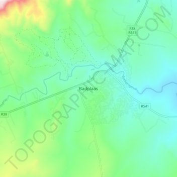
Name: Badplaas topographic map, elevation, terrain.
Average elevation: 1,152 m
Minimum elevation: 981 m
Maximum elevation: 1,699 m
Other topographic maps
Click on a map to view its topography, its elevation and its terrain.
Vygeboom Dam
South Africa > Mpumalanga > Gert Sibande > Albert Luthuli Local Municipality
Average elevation: 1,056 m
Mpuluzi
South Africa > Mpumalanga > Gert Sibande > Albert Luthuli Local Municipality
Average elevation: 1,618 m
Mpuluzi
South Africa > Mpumalanga > Gert Sibande > Albert Luthuli Local Municipality
Average elevation: 1,458 m
Mpuluzi
South Africa > Mpumalanga > Gert Sibande > Albert Luthuli Local Municipality
Average elevation: 1,458 m