
Queimadas topographic map
Interactive map
Click on the map to display elevation.
About this map
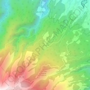
Name: Queimadas topographic map, elevation, terrain.
Location: Queimadas, Santana, Madère, 9230-108, Portugal (32.76360 -16.92604 32.80360 -16.88604)
Average elevation: 841 m
Minimum elevation: 241 m
Maximum elevation: 1,679 m
Other topographic maps
Click on a map to view its topography, its elevation and its terrain.
Pico Ruivo
Pico Ruivo, Santana, Madère, 9030-311, Portugal
Average elevation: 1,400 m
São Roque do Faial
São Roque do Faial, Santana, Madère, Portugal
Average elevation: 632 m
Achada do Teixeira
Achada do Teixeira, Estrada Regional 218, Ilha, Santana, Madère, 9230-108, Portugal
Average elevation: 1,264 m