
Thank you for supporting this site ❤️
Make a donation
Make a donation
Penn Valley topographic map
Click on the map to display elevation.
Thank you for supporting this site ❤️
Make a donation
Make a donation
About this map
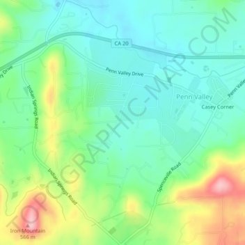
Name: Penn Valley topographic map, elevation, terrain.
Location: Penn Valley, Nevada County, California, United States (39.17932 -121.20912 39.21055 -121.17457)
Average elevation: 464 m
Minimum elevation: 415 m
Maximum elevation: 571 m
Thank you for supporting this site ❤️
Make a donation
Make a donation
Other topographic maps
Click on a map to view its topography, its elevation and its terrain.