
Thank you for supporting this site ❤️
Make a donation
Make a donation
Lewis Mountain topographic map
Click on the map to display elevation.
Thank you for supporting this site ❤️
Make a donation
Make a donation
About this map
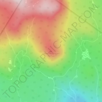
Name: Lewis Mountain topographic map, elevation, terrain.
Location: Lewis Mountain, Lewis, Essex County, Vermont, United States (44.90139 -71.77153 44.90149 -71.77143)
Average elevation: 662 m
Minimum elevation: 478 m
Maximum elevation: 898 m
Thank you for supporting this site ❤️
Make a donation
Make a donation
Other topographic maps
Click on a map to view its topography, its elevation and its terrain.
Silvio O. Conte National Fish And Wildlife Refuge
United States > Vermont > Essex County > Lewis
Average elevation: 213 m