
Pohatcong Township topographic map
Interactive map
Click on the map to display elevation.
About this map
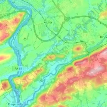
Name: Pohatcong Township topographic map, elevation, terrain.
Location: Pohatcong Township, Warren County, New Jersey, United States (40.59172 -75.20188 40.68674 -75.10836)
Average elevation: 119 m
Minimum elevation: 40 m
Maximum elevation: 294 m