
Hinterlangenbach topographic map
Interactive map
Click on the map to display elevation.
About this map
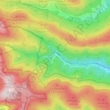
Name: Hinterlangenbach topographic map, elevation, terrain.
Average elevation: 849 m
Minimum elevation: 615 m
Maximum elevation: 1,086 m
Other topographic maps
Click on a map to view its topography, its elevation and its terrain.
Schönmünzach
Allemagne > Bade-Wurtemberg > Landkreis Freudenstadt > Baiersbronn
Schönmünzach, Baiersbronn, Landkreis Freudenstadt, Bade-Wurtemberg, Allemagne
Average elevation: 624 m
Rauhfels
Allemagne > Bade-Wurtemberg > Landkreis Freudenstadt > Baiersbronn > Tonbach
Rauhfels, Tonbach, Baiersbronn, Landkreis Freudenstadt, Bade-Wurtemberg, 72270, Allemagne
Average elevation: 672 m