
Cresta topographic map
Interactive map
Click on the map to display elevation.
About this map
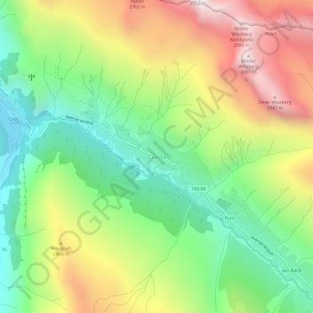
Name: Cresta topographic map, elevation, terrain.
Location: Cresta, Avers, Viamala, Grisons, 7447, Suisse (46.45291 9.49227 46.49291 9.53227)
Average elevation: 2,255 m
Minimum elevation: 1,703 m
Maximum elevation: 3,024 m
Other topographic maps
Click on a map to view its topography, its elevation and its terrain.