
Aintree Village topographic map
Interactive map
Click on the map to display elevation.
About this map
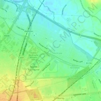
Name: Aintree Village topographic map, elevation, terrain.
Average elevation: 19 m
Minimum elevation: 7 m
Maximum elevation: 37 m
Other topographic maps
Click on a map to view its topography, its elevation and its terrain.
Southport
United Kingdom > England > Sefton
Southport, Sefton, Liverpool City Region, England, PR8 1AH, United Kingdom
Average elevation: 4 m
Merseyside
United Kingdom > England > West Lancashire > Wigan > Sefton
Merseyside, George's Lane, North Meols, West Lancashire, Lancashire, North West England, England, PR9 8HD, United Kingdom
Average elevation: 23 m