
Gemeinde Cacuaco topographic map
Interactive map
Click on the map to display elevation.
About this map
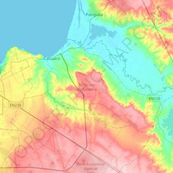
Name: Gemeinde Cacuaco topographic map, elevation, terrain.
Location: Gemeinde Cacuaco, Provinz Luanda, Angola (-8.91369 13.30297 -8.74278 13.61659)
Average elevation: 67 m
Minimum elevation: -3 m
Maximum elevation: 163 m