
Thank you for supporting this site ❤️
Make a donation
Make a donation
Idabel topographic map
Click on the map to display elevation.
Thank you for supporting this site ❤️
Make a donation
Make a donation
About this map
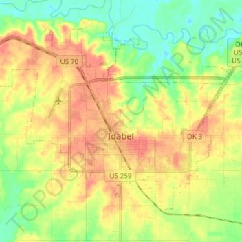
Name: Idabel topographic map, elevation, terrain.
Location: Idabel, McCurtain County, Oklahoma, United States (33.86348 -94.88950 33.94033 -94.76788)
Average elevation: 132 m
Minimum elevation: 102 m
Maximum elevation: 165 m
Thank you for supporting this site ❤️
Make a donation
Make a donation
Other topographic maps
Click on a map to view its topography, its elevation and its terrain.