
Klein-Leeukop topographic map
Interactive map
Click on the map to display elevation.
About this map
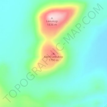
Name: Klein-Leeukop topographic map, elevation, terrain.
Average elevation: 1,615 m
Minimum elevation: 1,533 m
Maximum elevation: 1,840 m
Other topographic maps
Click on a map to view its topography, its elevation and its terrain.
Karoo Hoogland Ward 3
South Africa > Northern Cape > Namakwa District Municipality > Karoo Hoogland Local Municipality
Average elevation: 1,101 m
Hartbeeshoek
South Africa > Northern Cape > Namakwa District Municipality > Karoo Hoogland Local Municipality
Average elevation: 678 m