
Shanivarsanthe topographic map
Interactive map
Click on the map to display elevation.
About this map
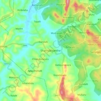
Name: Shanivarsanthe topographic map, elevation, terrain.
Location: Shanivarsanthe, Somawarpet taluk, Kodagu, Karnataka, India (12.68675 75.85064 12.76675 75.93064)
Average elevation: 948 m
Minimum elevation: 897 m
Maximum elevation: 1,046 m