
Densbüren topographic map
Interactive map
Click on the map to display elevation.
About this map
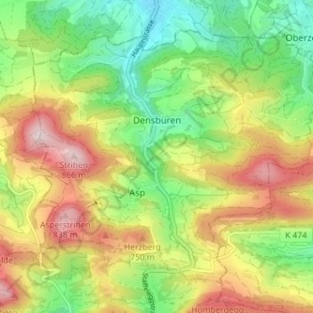
Name: Densbüren topographic map, elevation, terrain.
Location: Densbüren, Bezirk Aarau, Argovie, Suisse (47.43173 8.02845 47.46673 8.09239)
Average elevation: 609 m
Minimum elevation: 423 m
Maximum elevation: 850 m