
Cwm Parc topographic map
Interactive map
Click on the map to display elevation.
About this map
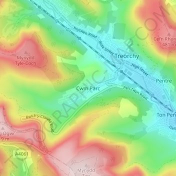
Name: Cwm Parc topographic map, elevation, terrain.
Average elevation: 309 m
Minimum elevation: 152 m
Maximum elevation: 532 m
Other topographic maps
Click on a map to view its topography, its elevation and its terrain.
Treorchy
Vereinigtes Königreich > Wales > Rhondda Cynon Taf
Treorchy, Rhondda Cynon Taf, Wales, Vereinigtes Königreich
Average elevation: 315 m
Aberdare
Vereinigtes Königreich > Wales > Rhondda Cynon Taf > Aberdare
Aberdare, Rhondda Cynon Taf, Wales, CF44 7NT, Vereinigtes Königreich
Average elevation: 275 m