
Annaberg-Lungötz topographic map
Interactive map
Click on the map to display elevation.
About this map
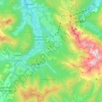
Name: Annaberg-Lungötz topographic map, elevation, terrain.
Location: Annaberg-Lungötz, Bezirk Hallein, Salzbourg, Autriche (47.45840 13.36765 47.54975 13.51618)
Average elevation: 1,214 m
Minimum elevation: 682 m
Maximum elevation: 2,378 m
Other topographic maps
Click on a map to view its topography, its elevation and its terrain.
Gamsfeld
Autriche > Salzbourg > Bezirk Hallein > Rußbach am Paß Gschütt
Gamsfeld, Rußbach am Paß Gschütt, Bezirk Hallein, Salzbourg, 5442, Autriche
Average elevation: 1,493 m