
Thank you for supporting this site ❤️
Make a donation
Make a donation
Along topographic map
Click on the map to display elevation.
Thank you for supporting this site ❤️
Make a donation
Make a donation
About this map
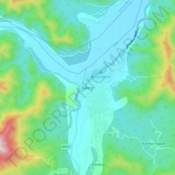
Name: Along topographic map, elevation, terrain.
Location: Along, Aalo HQ, West Siang, Arunachal Pradesh, India (28.12980 94.75854 28.20980 94.83854)
Average elevation: 386 m
Minimum elevation: 214 m
Maximum elevation: 1,068 m
Thank you for supporting this site ❤️
Make a donation
Make a donation