
Thank you for supporting this site ❤️
Make a donation
Make a donation
Pine Valley topographic map
Click on the map to display elevation.
Thank you for supporting this site ❤️
Make a donation
Make a donation
About this map
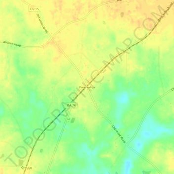
Name: Pine Valley topographic map, elevation, terrain.
Location: Pine Valley, Cook County, Georgia, United States (31.06741 -83.49322 31.10741 -83.45322)
Average elevation: 67 m
Minimum elevation: 48 m
Maximum elevation: 78 m
Thank you for supporting this site ❤️
Make a donation
Make a donation
Other topographic maps
Click on a map to view its topography, its elevation and its terrain.