
Thank you for supporting this site ❤️
Make a donation
Make a donation
Piła County topographic map
Click on the map to display elevation.
Thank you for supporting this site ❤️
Make a donation
Make a donation
About this map
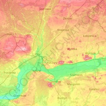
Name: Piła County topographic map, elevation, terrain.
Location: Piła County, Greater Poland Voivodeship, Poland (52.95167 16.39053 53.36383 17.43879)
Average elevation: 99 m
Minimum elevation: 34 m
Maximum elevation: 193 m
Thank you for supporting this site ❤️
Make a donation
Make a donation
Other topographic maps
Click on a map to view its topography, its elevation and its terrain.