
Cogula topographic map
Interactive map
Click on the map to display elevation.
About this map
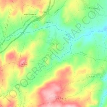
Name: Cogula topographic map, elevation, terrain.
Location: Cogula, Trancoso, Guarda, Portugal (40.79957 -7.30434 40.82084 -7.25055)
Average elevation: 558 m
Minimum elevation: 476 m
Maximum elevation: 657 m
Other topographic maps
Click on a map to view its topography, its elevation and its terrain.
Torre do Terrenho
Torre do Terrenho, Trancoso, Guarda, Portugal
Average elevation: 792 m
Golfar
Portugal > Guarda > Trancoso > Moreira de Rei
Golfar, Moreira de Rei, Trancoso, Guarda, 6420-153, Portugal
Average elevation: 762 m