
Thank you for supporting this site ❤️
Make a donation
Make a donation
Radom County topographic map
Click on the map to display elevation.
Thank you for supporting this site ❤️
Make a donation
Make a donation
About this map
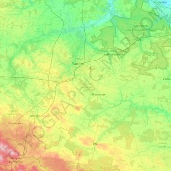
Name: Radom County topographic map, elevation, terrain.
Location: Radom County, Masovian Voivodeship, Poland (51.08034 20.75722 51.59137 21.56660)
Average elevation: 179 m
Minimum elevation: 106 m
Maximum elevation: 360 m
Thank you for supporting this site ❤️
Make a donation
Make a donation