
Grosbous topographic map
Interactive map
Click on the map to display elevation.
About this map
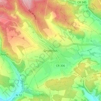
Name: Grosbous topographic map, elevation, terrain.
Location: Grosbous, Grosbous-Wahl, Canton Redange, 9154, Luxembourg (49.80756 5.94440 49.84756 5.98440)
Average elevation: 369 m
Minimum elevation: 288 m
Maximum elevation: 467 m