
Meuselwitz topographic map
Interactive map
Click on the map to display elevation.
About this map
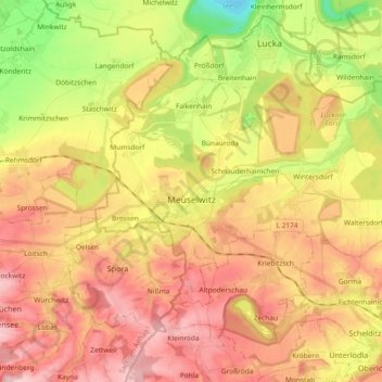
Name: Meuselwitz topographic map, elevation, terrain.
Location: Meuselwitz, Altenburger Land, Thuringia, 04610, Germany (51.01524 12.25081 51.08474 12.43586)
Average elevation: 189 m
Minimum elevation: 89 m
Maximum elevation: 269 m