
Sahambavy topographic map
Interactive map
Click on the map to display elevation.
About this map
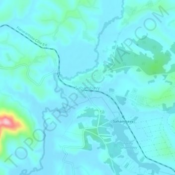
Name: Sahambavy topographic map, elevation, terrain.
Average elevation: 1,093 m
Minimum elevation: 1,069 m
Maximum elevation: 1,296 m
Other topographic maps
Click on a map to view its topography, its elevation and its terrain.
Farihy Sahambavy
Madagascar > Haute Matsiatra > Sahambavy
Farihy Sahambavy, Sahambavy, Haute Matsiatra, Province de Fianarantsoa, Madagascar
Average elevation: 1,087 m