
Thank you for supporting this site ❤️
Make a donation
Make a donation
Korzok Kangri topographic map
Click on the map to display elevation.
Thank you for supporting this site ❤️
Make a donation
Make a donation
About this map
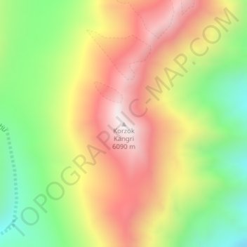
Name: Korzok Kangri topographic map, elevation, terrain.
Location: Korzok Kangri, Leh Tehsil, Leh district, Ladakh, India (33.04487 78.23634 33.04497 78.23644)
Average elevation: 5,635 m
Minimum elevation: 5,178 m
Maximum elevation: 6,093 m
Thank you for supporting this site ❤️
Make a donation
Make a donation
Other topographic maps
Click on a map to view its topography, its elevation and its terrain.