
Imzizou topographic map
Interactive map
Click on the map to display elevation.
About this map
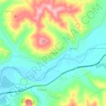
Name: Imzizou topographic map, elevation, terrain.
Location: Imzizou, Freha, Daïra Azazga, Tizi Ouzou, Algérie (36.69843 4.22029 36.73843 4.26029)
Average elevation: 160 m
Minimum elevation: 92 m
Maximum elevation: 286 m
Other topographic maps
Click on a map to view its topography, its elevation and its terrain.
Tamda
Algérie > Tizi Ouzou > Daïra Azazga > Freha
Tamda, Freha, Daïra Azazga, Tizi Ouzou, 15341, Algérie
Average elevation: 139 m