
Fayot topographic map
Interactive map
Click on the map to display elevation.
About this map
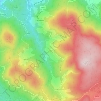
Name: Fayot topographic map, elevation, terrain.
Average elevation: 879 m
Minimum elevation: 678 m
Maximum elevation: 1,075 m
Other topographic maps
Click on a map to view its topography, its elevation and its terrain.
Le Roc Pointu
France > Auvergne-Rhône-Alpes > Allier > Saint-Nicolas-des-Biefs > Fayot
Le Roc Pointu, Fayot, Saint-Nicolas-des-Biefs, Vichy, Allier, Auvergne-Rhône-Alpes, France métropolitaine, 03250, France
Average elevation: 912 m