
Thank you for supporting this site ❤️
Make a donation
Make a donation
Pilot topographic map
Click on the map to display elevation.
Thank you for supporting this site ❤️
Make a donation
Make a donation
About this map
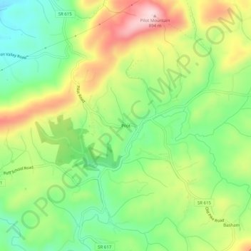
Name: Pilot topographic map, elevation, terrain.
Location: Pilot, Montgomery County, Virginia, 24138, United States (37.03208 -80.38366 37.07208 -80.34366)
Average elevation: 722 m
Minimum elevation: 603 m
Maximum elevation: 887 m
Thank you for supporting this site ❤️
Make a donation
Make a donation
Other topographic maps
Click on a map to view its topography, its elevation and its terrain.