
Thank you for supporting this site ❤️
Make a donation
Make a donation
Batu Gajah topographic map
Click on the map to display elevation.
Thank you for supporting this site ❤️
Make a donation
Make a donation
About this map
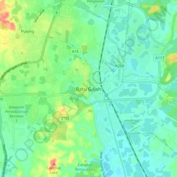
Name: Batu Gajah topographic map, elevation, terrain.
Location: Batu Gajah, Kinta, Perak, 31000, Malaysia (4.43053 100.99699 4.51053 101.07699)
Average elevation: 37 m
Minimum elevation: 15 m
Maximum elevation: 99 m
Thank you for supporting this site ❤️
Make a donation
Make a donation
Other topographic maps
Click on a map to view its topography, its elevation and its terrain.