
Thank you for supporting this site ❤️
Make a donation
Make a donation
Lekeryd topographic map
Click on the map to display elevation.
Thank you for supporting this site ❤️
Make a donation
Make a donation
About this map
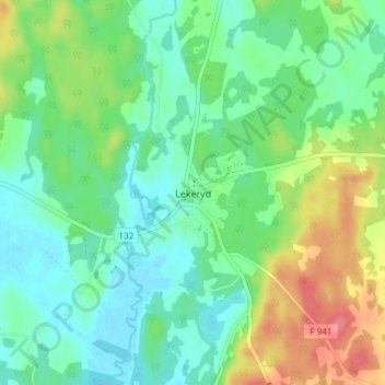
Name: Lekeryd topographic map, elevation, terrain.
Location: Lekeryd, Jönköpings kommun, Jönköping County, Sweden (57.75337 14.39822 57.79337 14.43822)
Average elevation: 235 m
Minimum elevation: 212 m
Maximum elevation: 282 m
Thank you for supporting this site ❤️
Make a donation
Make a donation
Other topographic maps
Click on a map to view its topography, its elevation and its terrain.
Thank you for supporting this site ❤️
Make a donation
Make a donation
Thank you for supporting this site ❤️
Make a donation
Make a donation
Thank you for supporting this site ❤️
Make a donation
Make a donation