
Yantai topographic map
Interactive map
Click on the map to display elevation.
About this map
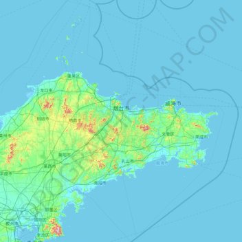
Name: Yantai topographic map, elevation, terrain.
Location: Yantai, Shandong, 264000, Chine (36.06645 119.54889 38.55837 121.92903)
Average elevation: 30 m
Minimum elevation: -2 m
Maximum elevation: 951 m
Other topographic maps
Click on a map to view its topography, its elevation and its terrain.