
Nayapul topographic map
Interactive map
Click on the map to display elevation.
About this map
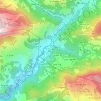
Name: Nayapul topographic map, elevation, terrain.
Location: Nayapul, Lumle, Annapurna, कास्की, Gandaki Pradesh, Nepal (28.27814 83.74791 28.31814 83.78791)
Average elevation: 1,320 m
Minimum elevation: 921 m
Maximum elevation: 2,003 m