
Mürow topographic map
Interactive map
Click on the map to display elevation.
About this map
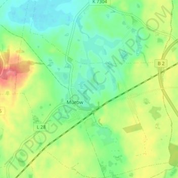
Name: Mürow topographic map, elevation, terrain.
Location: Mürow, Angermünde, Uckermark, Brandenburg, Deutschland (53.03670 14.01216 53.07636 14.07058)
Average elevation: 48 m
Minimum elevation: 19 m
Maximum elevation: 94 m