
Parque Central topographic map
Interactive map
Click on the map to display elevation.
About this map
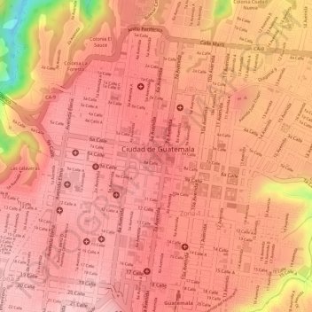
Name: Parque Central topographic map, elevation, terrain.
Location: Parque Central, Zona 1, Guatemala City, Guatemala (14.64122 -90.51396 14.64246 -90.51259)
Average elevation: 1,487 m
Minimum elevation: 1,345 m
Maximum elevation: 1,522 m