
Mittelpöllnitz topographic map
Interactive map
Click on the map to display elevation.
About this map
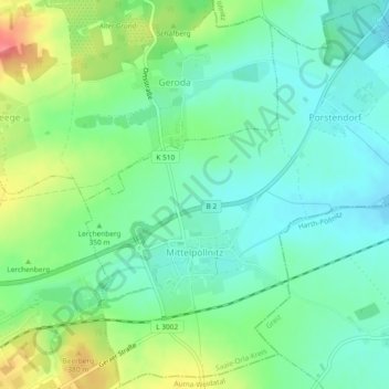
Name: Mittelpöllnitz topographic map, elevation, terrain.
Location: Mittelpöllnitz, Triptis, Saale-Orla-Kreis, Thuringe, Allemagne (50.74485 11.89755 50.77369 11.94395)
Average elevation: 349 m
Minimum elevation: 324 m
Maximum elevation: 400 m
Other topographic maps
Click on a map to view its topography, its elevation and its terrain.
Bad Lobenstein
Allemagne > Thuringe > Saale-Orla-Kreis
Bad Lobenstein, Saale-Orla-Kreis, Thuringe, 07356, Allemagne
Average elevation: 560 m
Schleiz
Allemagne > Thuringe > Saale-Orla-Kreis
Schleiz, Saale-Orla-Kreis, Thuringe, 07907, Allemagne
Average elevation: 480 m