
Thank you for supporting this site ❤️
Make a donation
Make a donation
Íllora topographic map
Click on the map to display elevation.
Thank you for supporting this site ❤️
Make a donation
Make a donation
About this map
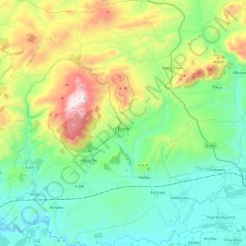
Name: Íllora topographic map, elevation, terrain.
Location: Íllora, Partido Judicial de Loja, Granada, Andalusië, Spanje (37.19666 -3.99663 37.38828 -3.80998)
Average elevation: 811 m
Minimum elevation: 487 m
Maximum elevation: 1,594 m
Thank you for supporting this site ❤️
Make a donation
Make a donation
Other topographic maps
Click on a map to view its topography, its elevation and its terrain.