
Thank you for supporting this site ❤️
Make a donation
Make a donation
Les Gardes topographic map
Click on the map to display elevation.
Thank you for supporting this site ❤️
Make a donation
Make a donation
About this map
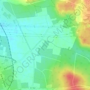
Name: Les Gardes topographic map, elevation, terrain.
Average elevation: 49 m
Minimum elevation: 29 m
Maximum elevation: 87 m
Thank you for supporting this site ❤️
Make a donation
Make a donation
Other topographic maps
Click on a map to view its topography, its elevation and its terrain.
Saint-Cyr-en-Bourg
France > Pays de la Loire > Maine-et-Loire > Bellevigne-les-Châteaux
Average elevation: 57 m