
Branchville topographic map
Interactive map
Click on the map to display elevation.
About this map
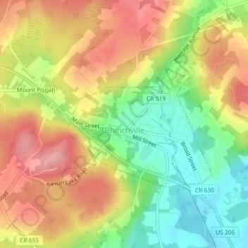
Name: Branchville topographic map, elevation, terrain.
Location: Branchville, Sussex County, New Jersey, 07890, United States (41.14028 -74.76088 41.15404 -74.73967)
Average elevation: 214 m
Minimum elevation: 148 m
Maximum elevation: 276 m